


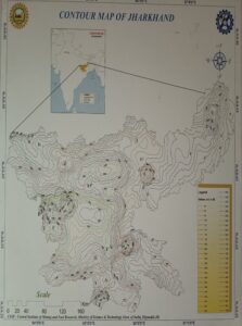
The contour map indicates the height above the sea level of a place over which the lines/contours are crossing. The terrain of a particular area can be figured out from the contour map. This is contour map of Jharkhand which is basically Chhotanagpur Plateau.


